Plan, Edit, Organize, Share
The ultimate GPX editor and route planner for adventurers. Create, edit, organize, and share GPX files with advanced route planning, smart file organization, stunning maps, location-based media, and rich data visualizations.
Powerful Tools for Adventures
Everything you need to plan, edit, and share your outdoor activities
Planning
A suite of tools for performing all common file processing tasks, and which can be applied to multiple files at once.
Routing & Profiles
Choose from multiple activity profiles including bike, hike, car, motorcycle, and more. The router finds the best path using road and trail networks.

Expert Controls & Custom Profiles Pro
Pro members can take full control of how routes are calculated — then save their setups to reuse anytime.
Expert Routing Controls
The Expert dialog exposes the routing engines' cost model — surface preferences, way penalties, elevation cost, and more — with per-activity controls that let you tune routing exactly how you wish. If you prefer certain road types, trails, hills, etc. Try it below — expand a section and drag a slider.
Custom Routing Profiles
Save your tuned routing settings as your own custom routing profile. Reuse it to create a new route or use it with the Reroute tool to modify an existing track. Want to go further — Export and share your unique settings or even build your own Brouter profile!

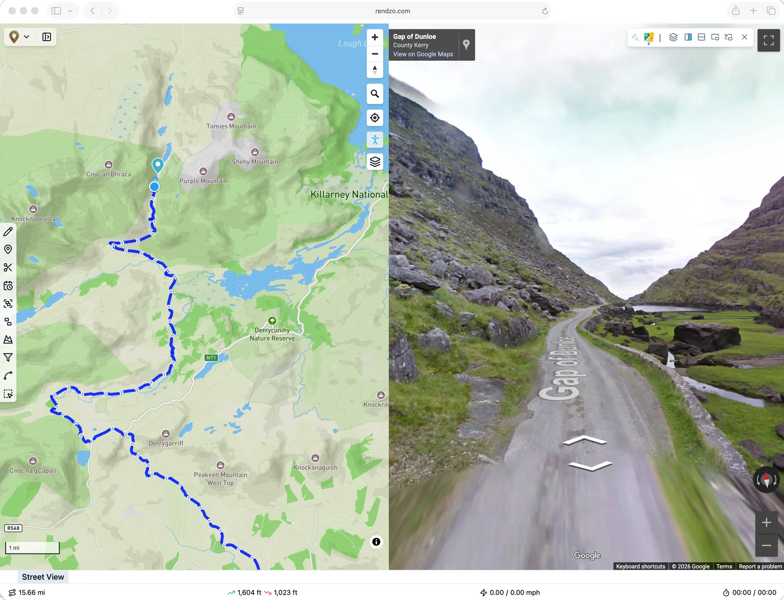
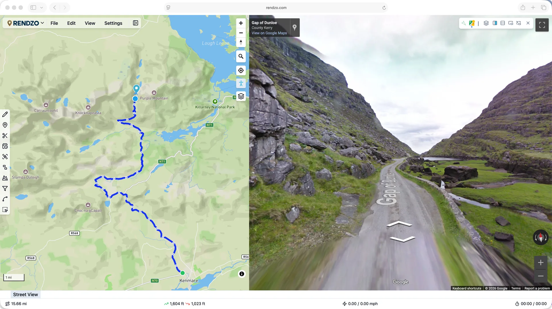
Street View
See any point on your route at ground level without leaving Rendzo. Click the map, hover the elevation profile, or drag a routing anchor — the floating street view window shows imagery for that exact spot, facing your direction of travel. Switch between Google Street View and Mapillary (great for trails and off-road), or pop the viewer out to a second monitor.
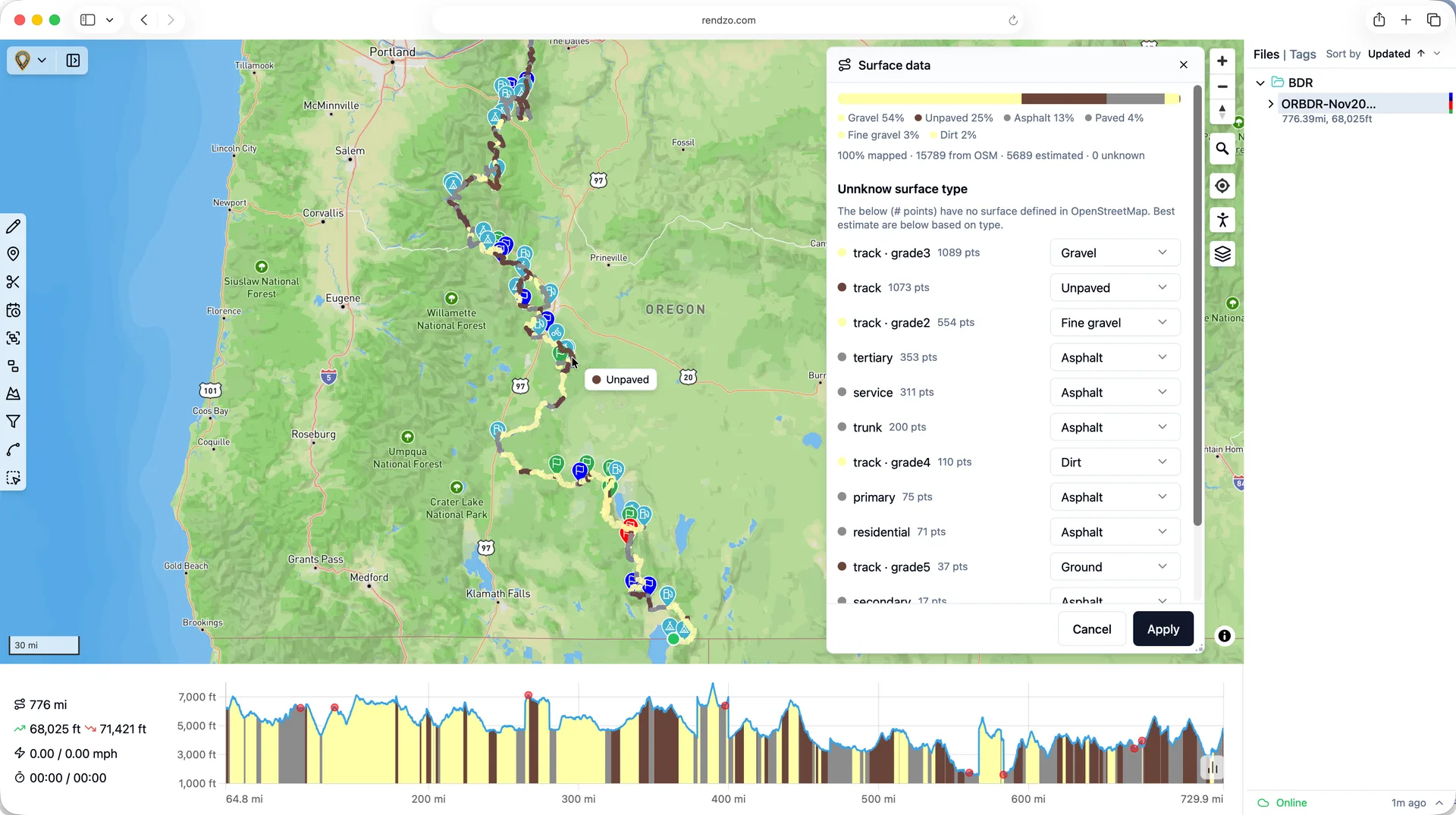
Surface Data
Know what’s under your wheels before you ride. Request surface data and Rendzo colors your whole track — asphalt, gravel, dirt, sand — live on the map and elevation profile, with surface types pulled straight from OpenStreetMap. Review coverage, resolve any untagged roads with smart grade-aware defaults, then apply. Turn on View → Surface to color every visible track at once.
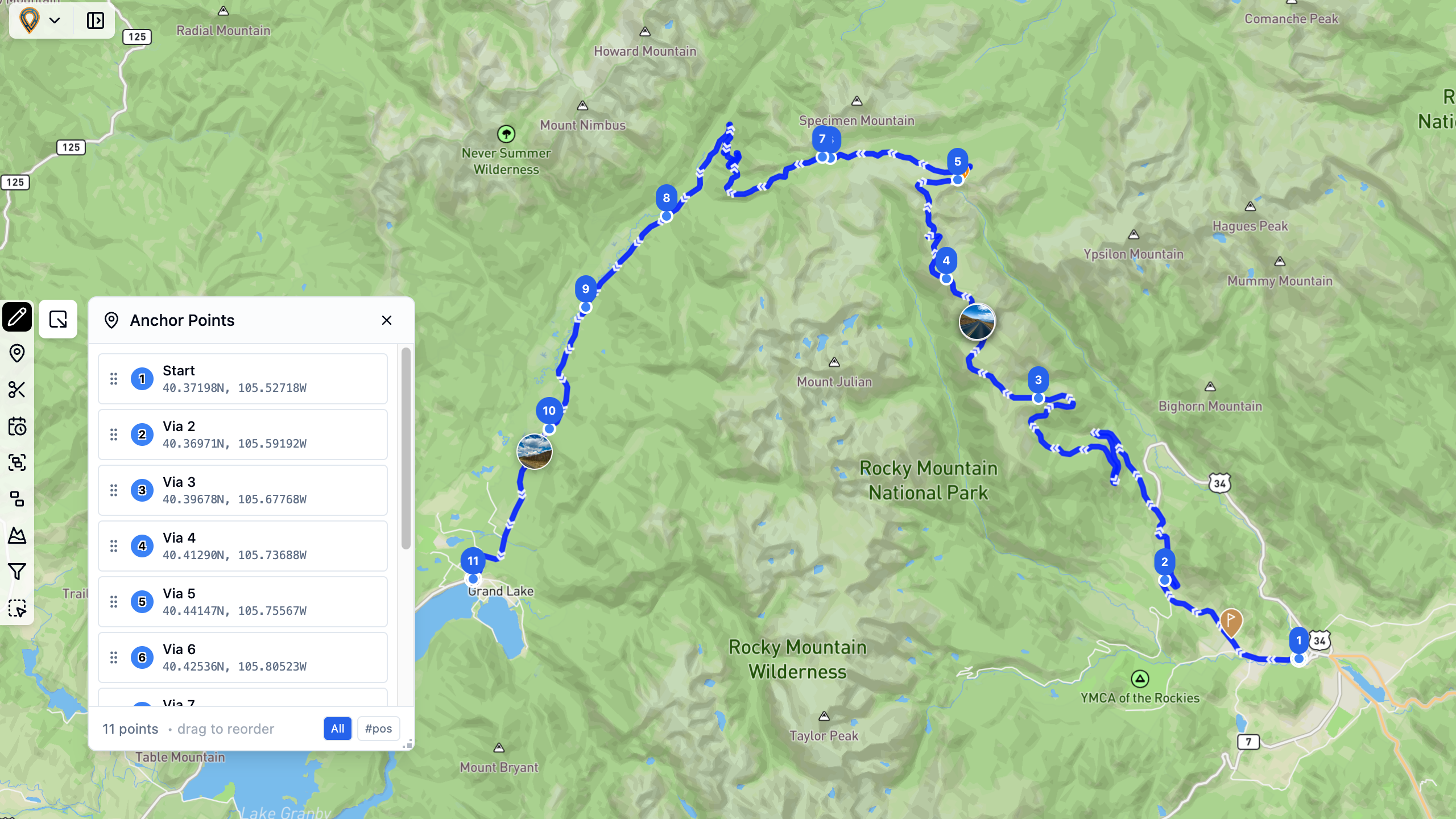
Anchor Points
Click to place anchor points, drag to reshape your route. View, reorder, and fine-tune every turn of your journey.
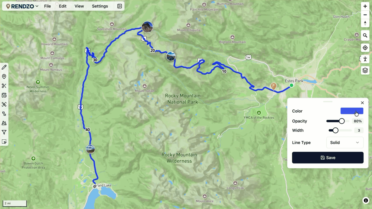
Route Appearance
Customize route colors, line styles, width, and opacity. Make each track visually distinct on your map.
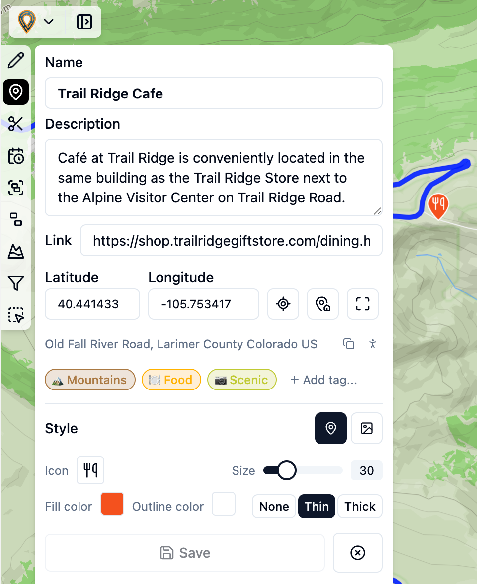
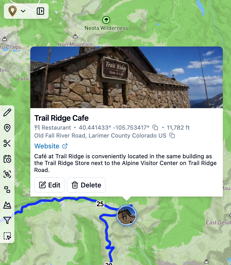
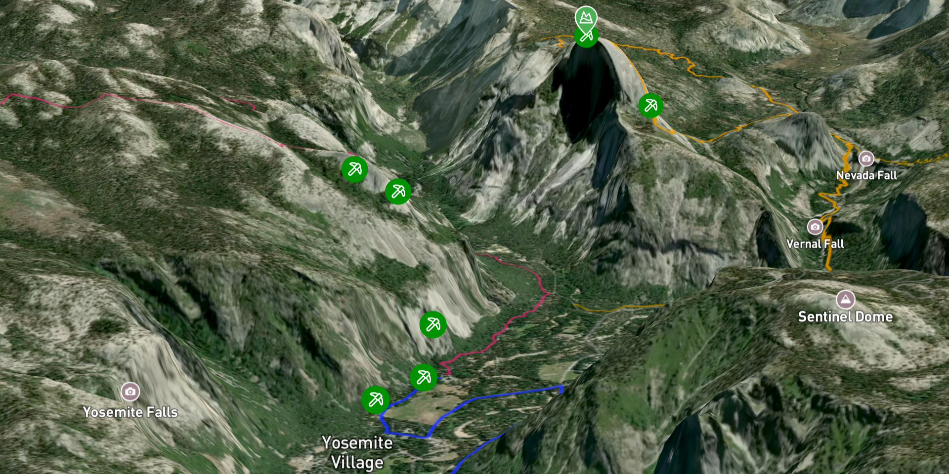
Waypoints
Add points of interest with custom icons, images, and address lookup. Style them with colors, sizes, and borders.
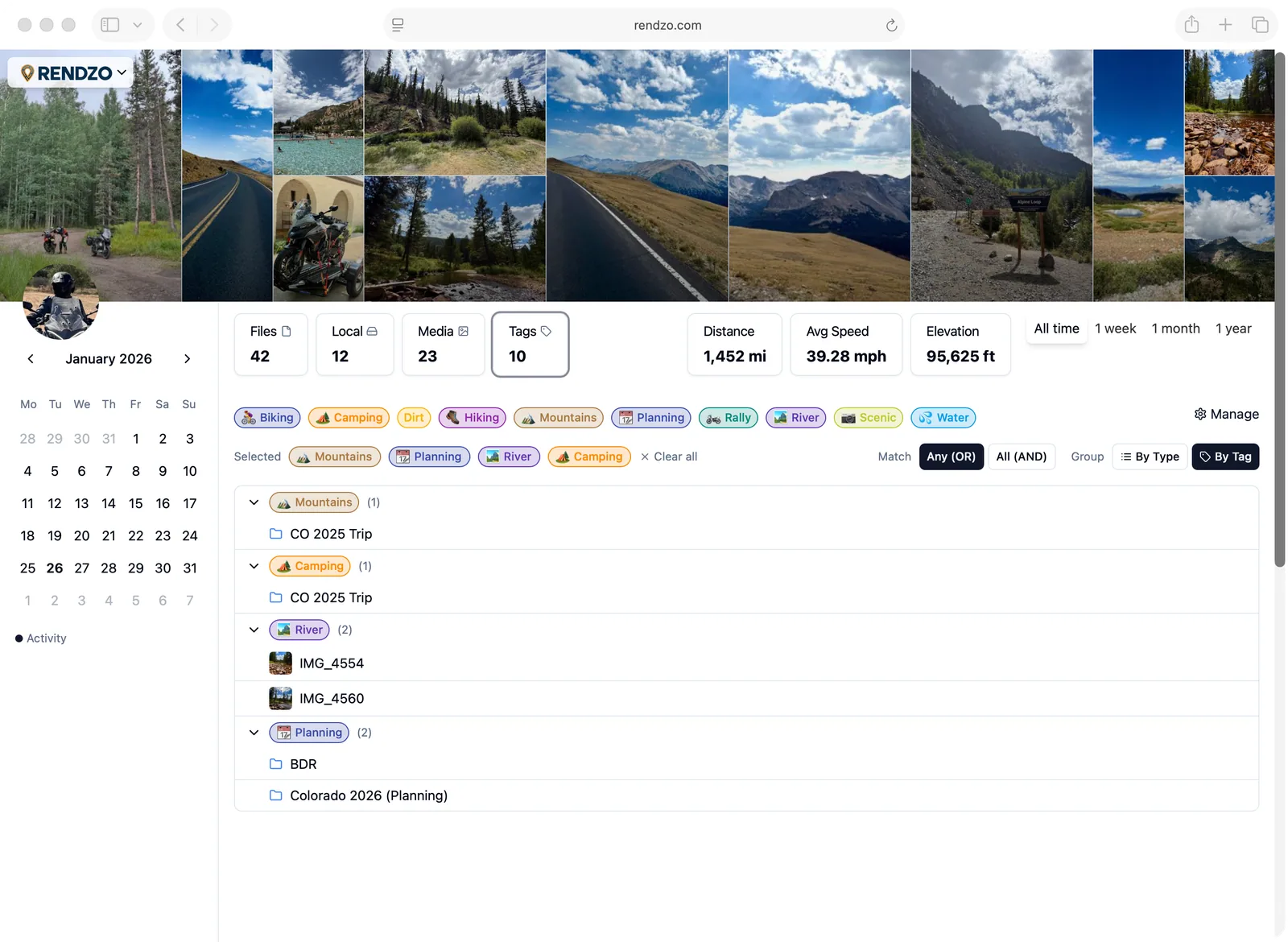
Organization
Organize your GPX files with tags, folders, and use smart filtering to find what you're looking for. Keep your adventures structured and easy to find with folders and sub-folders. Create color-coded tags and apply them to files, folders, media, and waypoints for flexible organization.
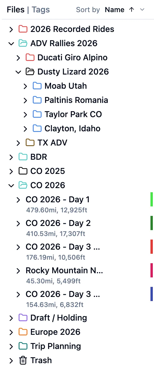
Tags
Files
Maps
A large collection of basemaps, overlays and points of interest to help you craft your next outdoor adventure, or visualize your latest achievement.


Map Styles
Choose from many of basemaps including 3D, outdoor topo, satellite imagery, cycling-specific maps, and country-specific cartography.
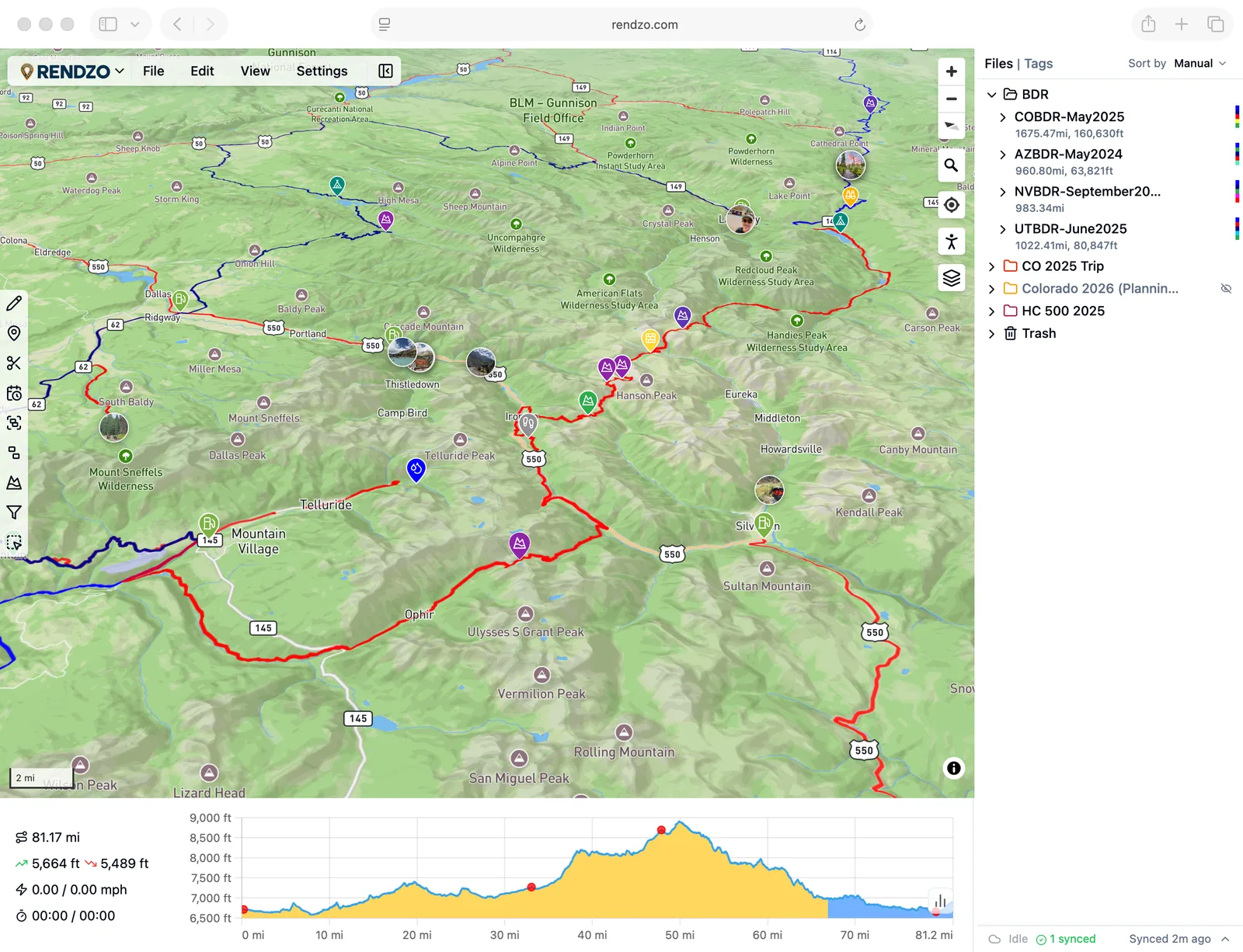
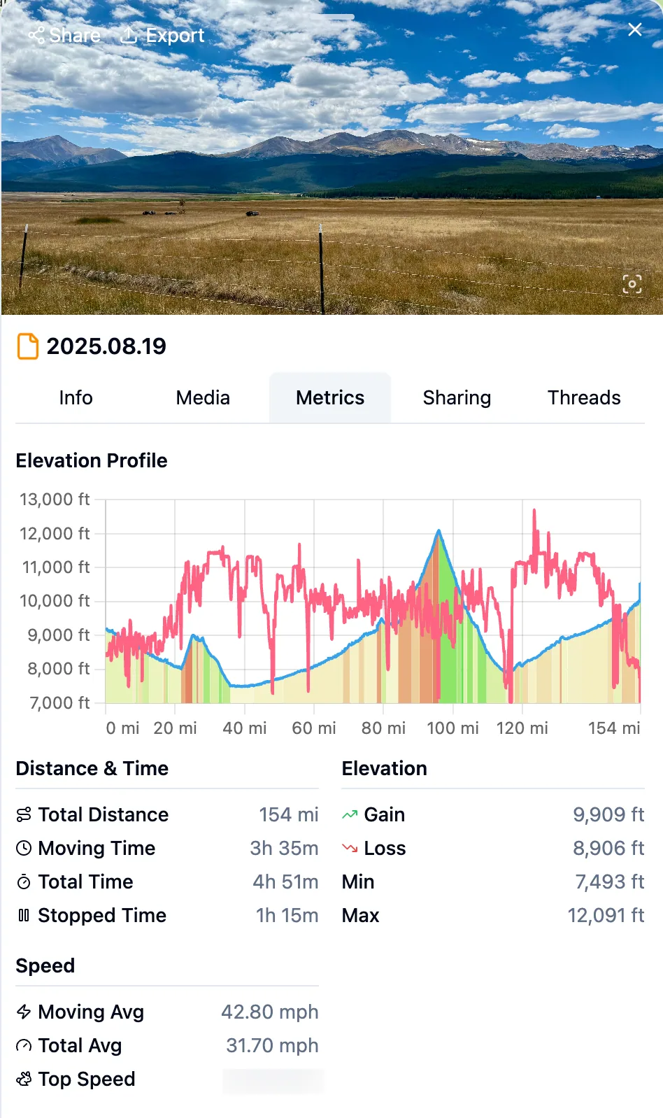
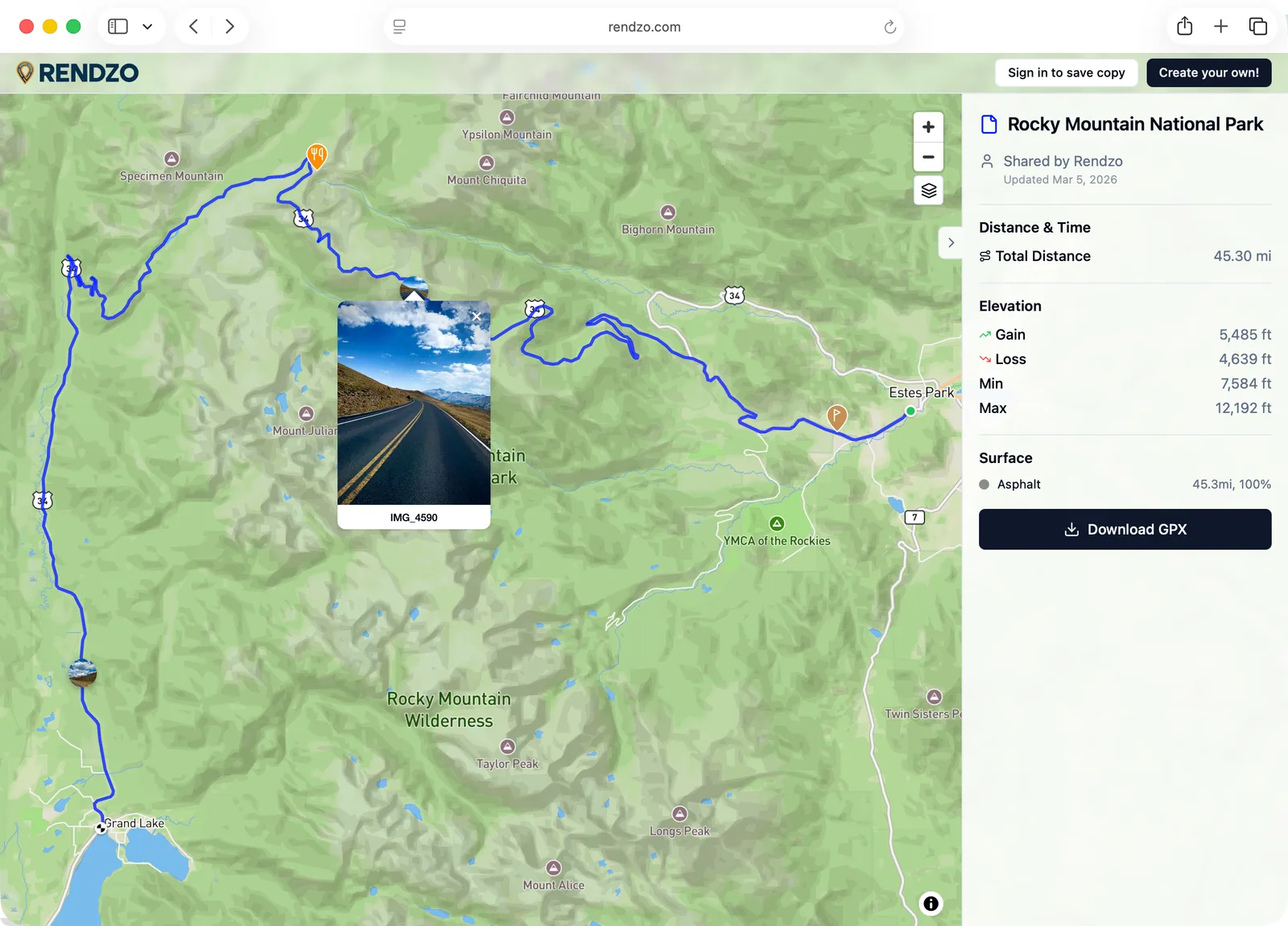
Data Visualization & Statistics
An interactive elevation profile with detailed statistics to analyze recorded activities and explore plans. See important geographical information such as Surface type, Category and Slope of terrain. View recorded heart rate, cadence, etc. Also see where your Waypoints are visually on the graph.
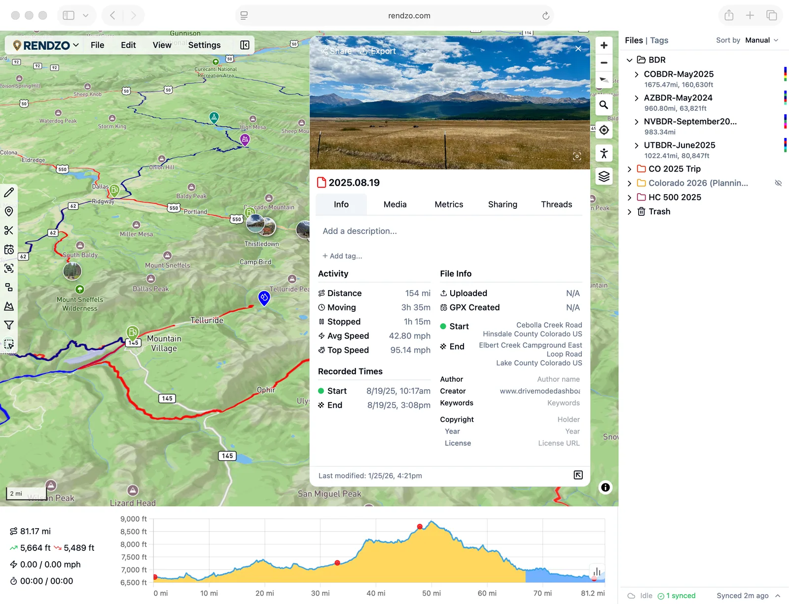
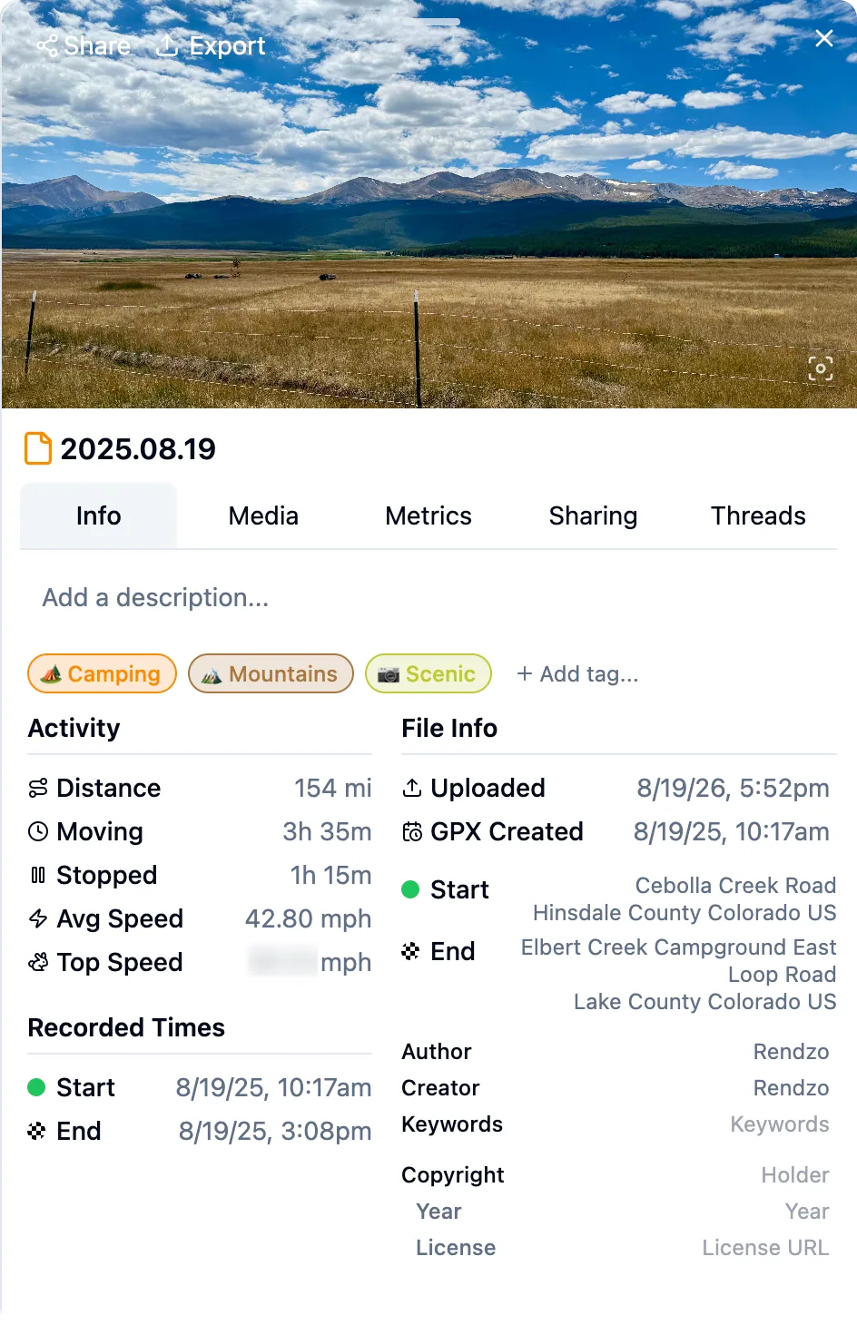
Info Panel
View and edit detailed metadata for your files, tracks, and waypoints. See statistics, timestamps, coordinates, and customize names, descriptions, and tags.
Sharing
Share your files and folders with friends, riding groups, or the public. Recipients see your content on a beautiful full-screen map preview — no Rendzo account required. Pro subscibers can share to other Rendzo users for collobration with editor or viewer access.
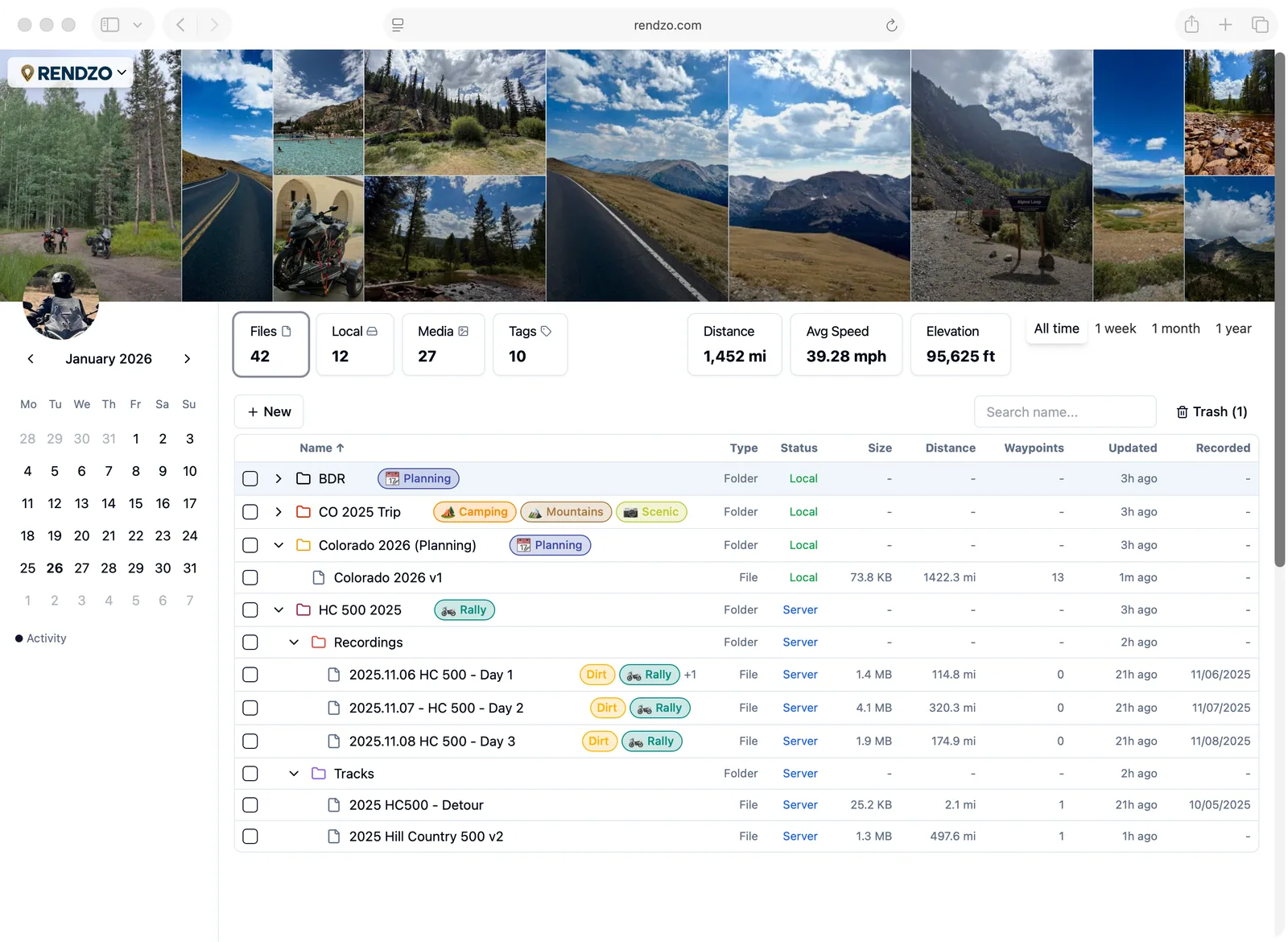
Dashboard
Your central hub for managing all your GPX files, folders, and activities. See stats and activity details for your trips, view activity by date, or view activity by tag. See and manage your media files and what's shared with others.

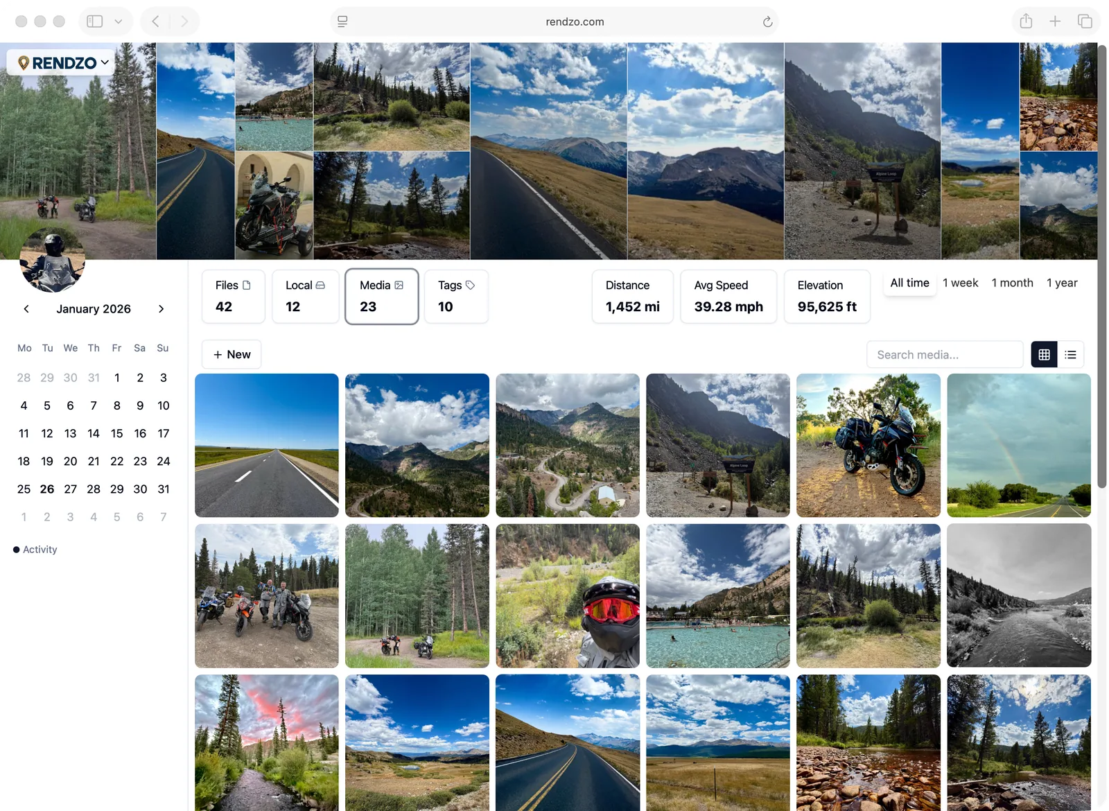
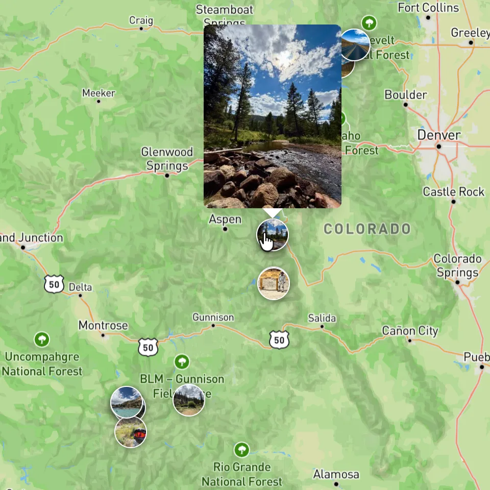
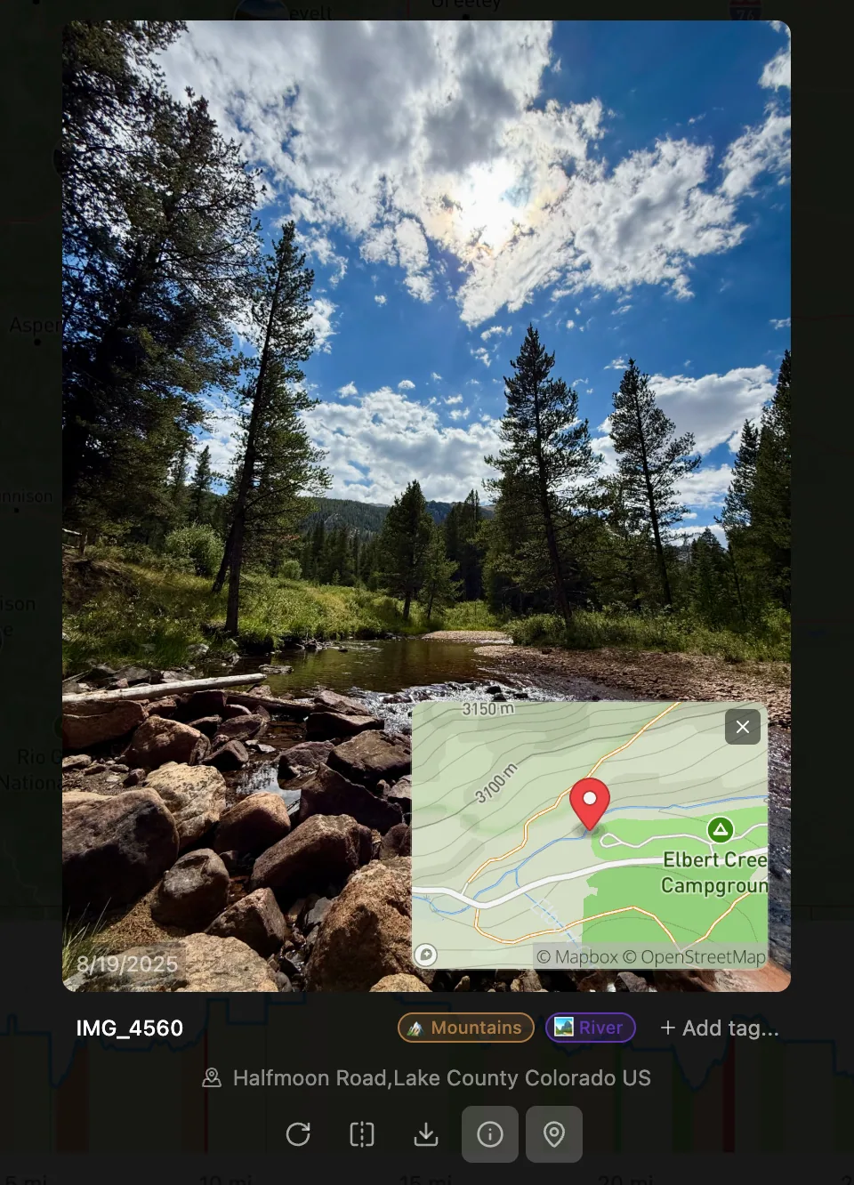
Media
Your photos deserve to be seen in the context and on the map where they were taken, right along with your trip details and travels. Display media directly on the map, add photos or videos to a specific GPX file, folder, or waypoint. Media can be associated with one or more files, folders, and waypoints. Media can also be tagged for flexible organization and easy retrieval.
Start Your 7-Day Free Trial
Try any plan free for 7 days. No charge until your trial ends. Cancel anytime.
Standard
$50 billed annually (save 17%)
Perfect for casual adventurers and route planning
- Route planning & editing tools
- Reroute tool to snap & clean tracks onto roads and trails
- Expert routing controls to fine-tune how routes are calculated
- Custom routing profiles to save & reuse your own routing preferences
- Folders, sub-folders, & Tagging for files, folders, media, & waypoints
- Dashboard to organize andmanage your activities
- Statistics (speed, elevation, distance, time, etc) and Elevation Profiles
- Multiple map styles including 3D terrain, satellite, offroad, and more
- Share GPX Files & Folders (public only)
- Share with custom permissions (viewer, editor)
- GPX files per account: 25 files
- Media files: 100 files
- Cloud storage: 10 GB
- Priority support
Cancel anytime! Simple no-hassle cancellation.
Pro
$100 billed annually (save 17%)
For serious adventurers who need unlimited storage
- Everything in Standard, plus:
- Reroute tool to snap & clean tracks onto roads and trails
- Expert routing controls to fine-tune how routes are calculated
- Custom routing profiles to save & reuse your own routing preferences
- Share with custom permissions (viewer, editor)
- GPX files per account: Unlimited¹
- Media files: Unlimited¹
- Cloud storage: Unlimited¹
- Priority support
Cancel anytime! Simple no-hassle cancellation.
¹ Unlimited plans are subject to our fair use policy for reasonable personal use. Contact support if you need additional capacity.
Have questions? Check our FAQ